Focus Region Tool
I developed this tool during the research project on “focus regions” at the university of Würzburg in collaboration with Jan-Henrik Haunert. This leads to my first publication.
Project Objective:
The tool allows the user to choose a focus region within a larger area on a road map, together with a zoom factor. By solving a convex quadratic program a new visualization of the road map is created, where all elements in the focus region are scaled by the zoom factor, all elements outside the area stay untouched and the elements within the area but outside the focus region are moved such that the distortions are minimized.
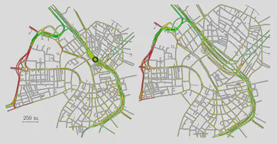
The result is a new map, where the focus region is strongly enlarged, but still the map looks topologically very similar to the original map.
A typical use case is the visualization of a long route from a dense city to another dense city on a GPS unit. You can enlarge the area close to the origin and destination, where typically a lot of small roads are important for the driver. The route on the highway between the cities is usually easier to navigate, so it could be shrunk.
The result is a visualization of the whole route within a road map that still looks quite similar to the original one, but the two focus regions are enlarged such that each turn is clearly visible.
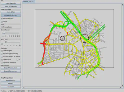
Technological Stack:
The software is written in JAVA and uses CPLEX for solving a convex quadratic program.